Problem
Turning Danish LiDAR point-cloud data into something suitable for
3D printing requires considerably more than simply converting points
into an STL file.
Solution
GeoPrint processes geographic data for a selected area and transforms
the relevant terrain, buildings and other features into geometry that
can eventually be manufactured on a 3D printer.
Process
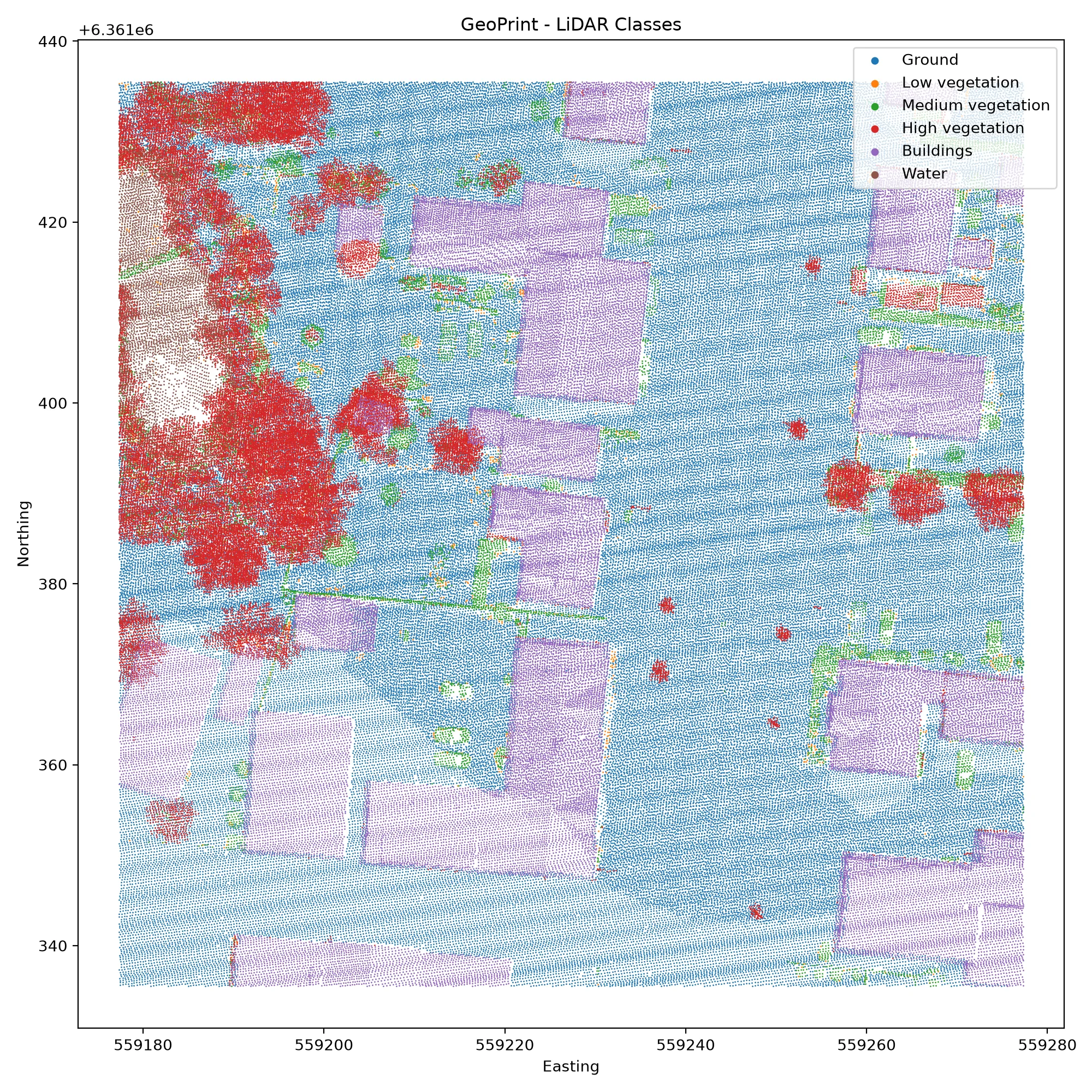
The pipeline retrieves point-cloud data, crops it to the requested
area and analyses classifications such as terrain, vegetation and
buildings before generating printable geometry.



Result
The project is developing into a pipeline capable of turning a Danish
address into a physical representation of its surroundings.